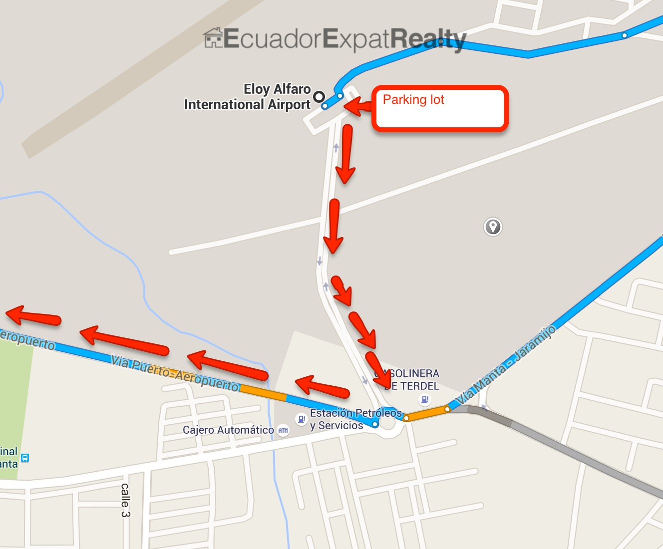
To start, the rental car area will probably be on the corner of the parking lot. Google doesn’t quite get this part right.
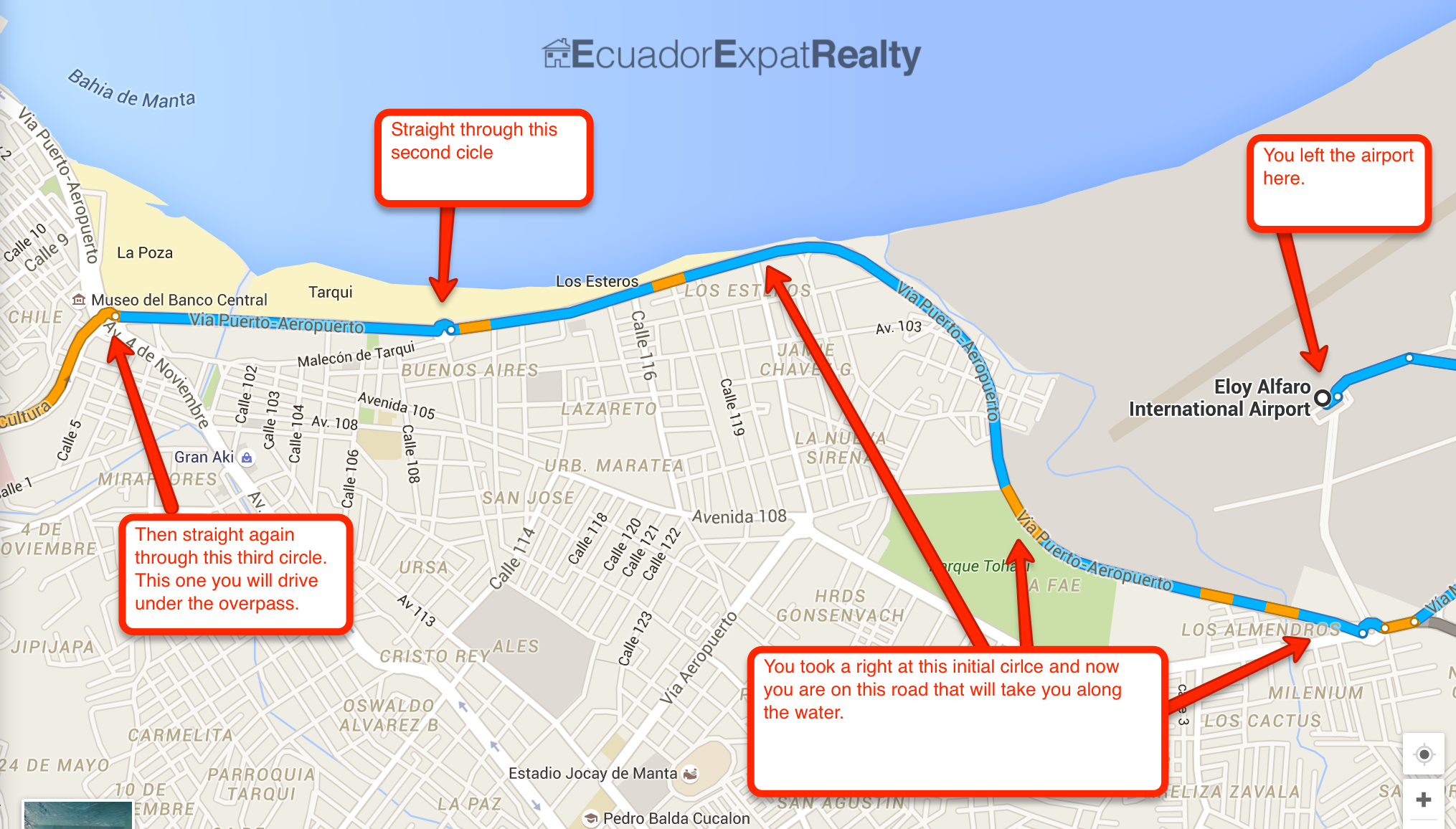
To exit the airport, all you need to really do is just drive straight out of the parking lot and follow that short road until you hit your first roundabout. It’s a large roundabout. Take the first exit to your right out of that roundabout.
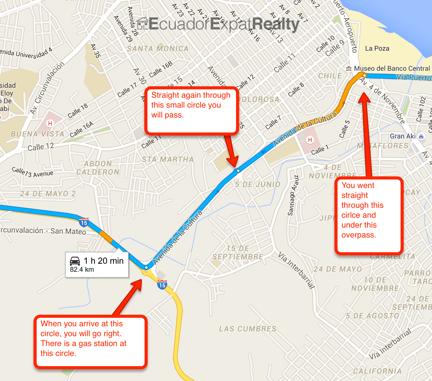
Once, you take that right through the roundabout, you’ll end up on a road that will eventually put you traveling along the water. You’ll be passing boats, the shore and looking out towards the marina and downtown Manta. You’ll pass straight through a couple circles, one of which will take you under an overpass.
Once under the overpass. You’ll continue on that road, passing straight through a smaller circle, then coming to another larger circle where your options will be left or right. Go right.
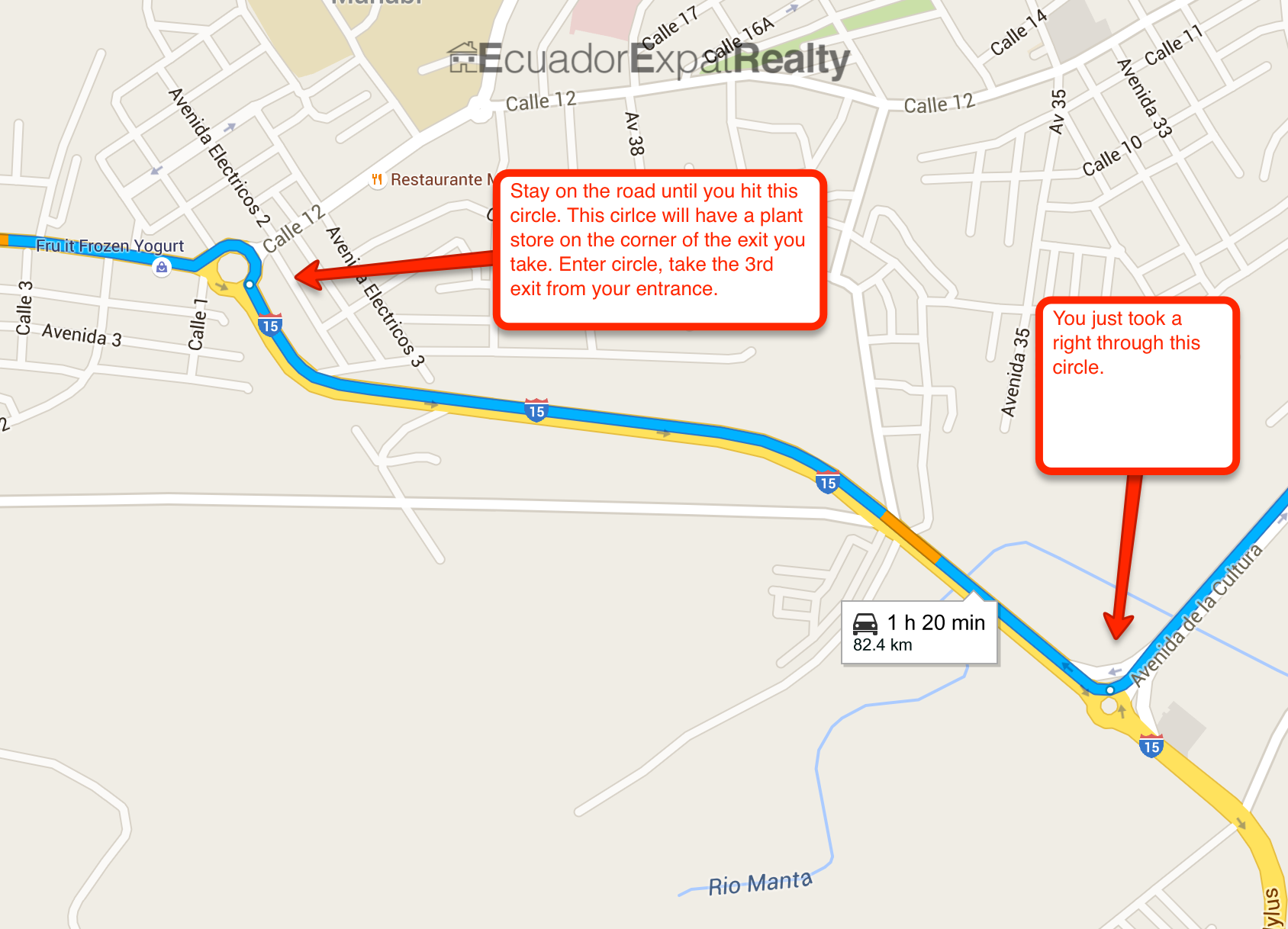
Once you go right through this circle, get into your left lane. We are going to take the quicker route then google recommends.
Once you go right through the circle, guess what, stay on that road straight until you hit another circle.
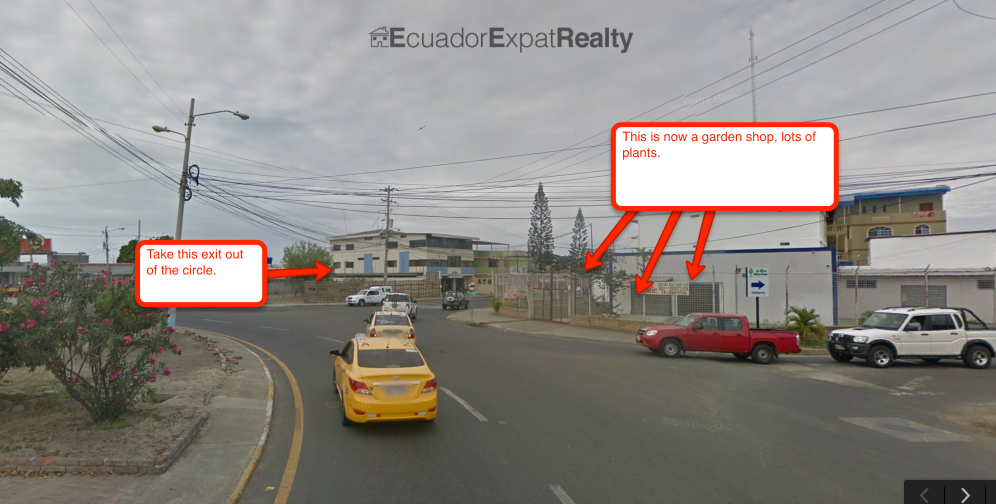
You’ll enter back into town a bit before you hit the next circle. When you get to it, you exit left out of it (the 3rd exit from where you entered). You’ll know it’s the right point to exit the circle because it will be the corner with the gardner shop on the corner.
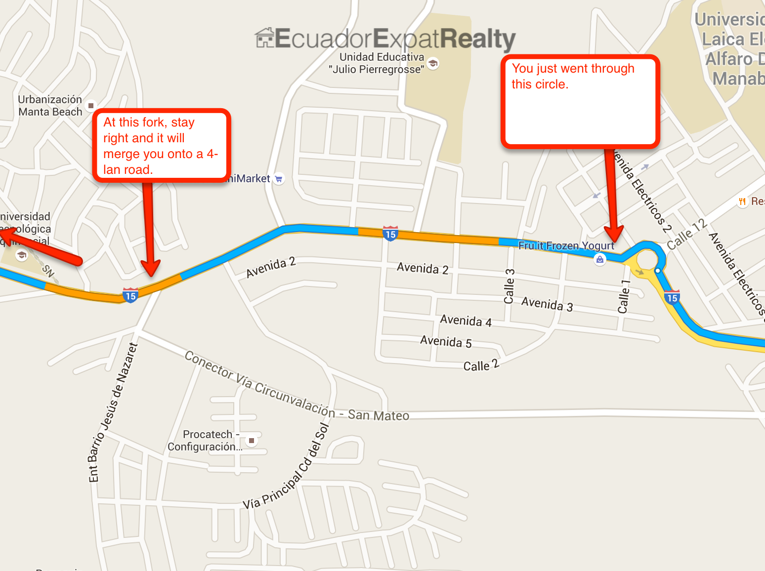
At this point you are pretty much through the hard stuff. Go straight down this road until you hit a fork which you will stay right on and it will naturally merge into a larger 4-lane major road.
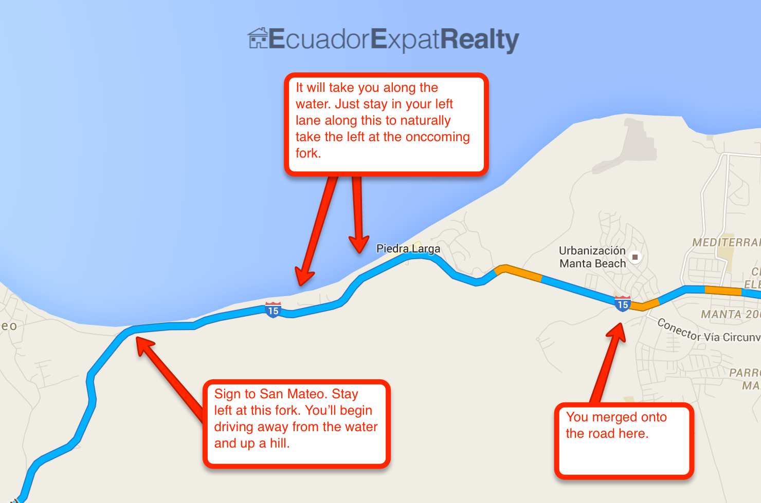
Now you are on the main coastal road. Just drive along this road. It will drop you back down along the water after passing a couple entrances to larger communities. As you drive along the water, you’ll come to a bit of a fork at which you will stay left. (If you go right, it will take you into Santa Marianita). STAY LEFT.
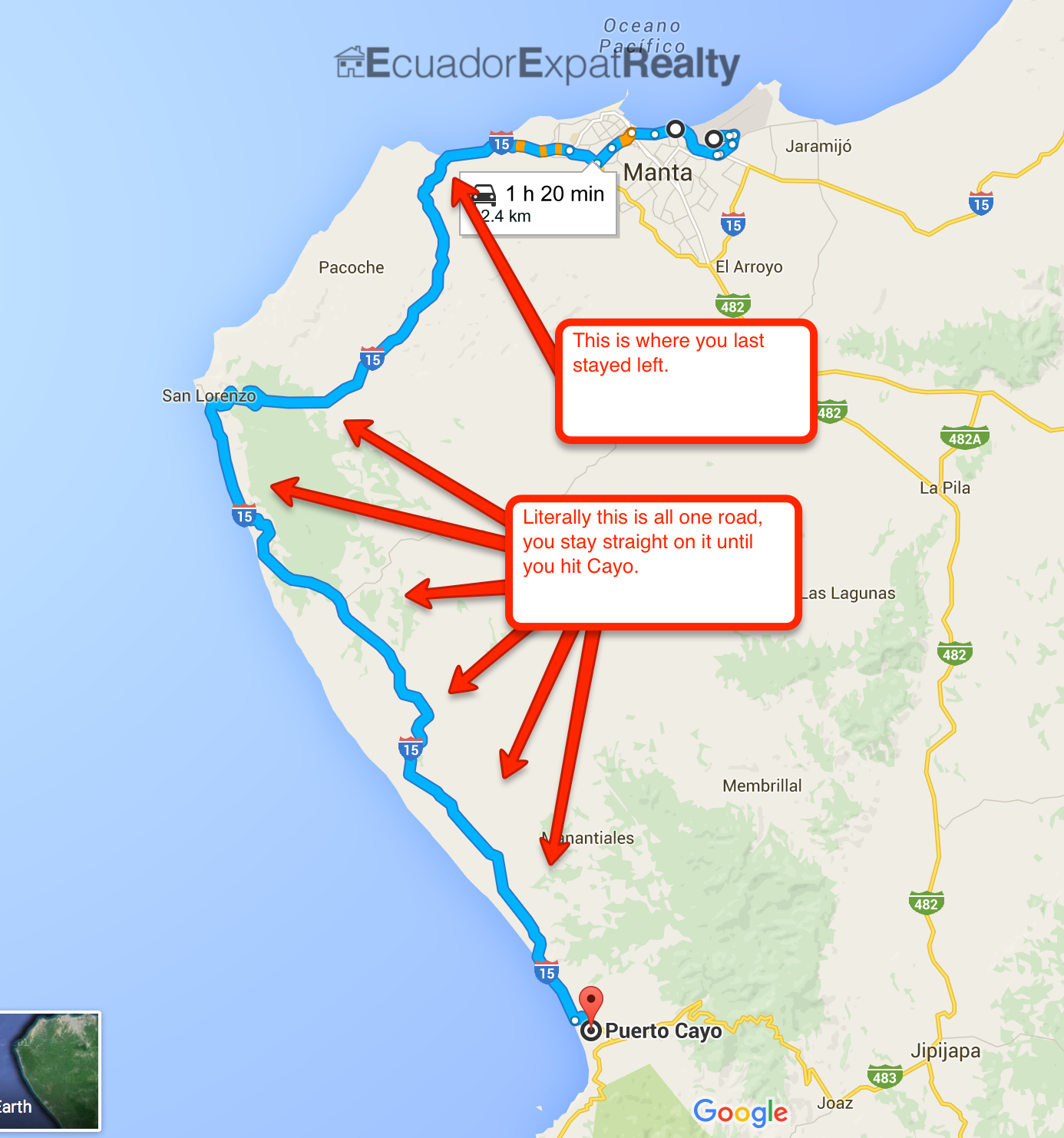
At this point, you are really on the easy path. All you do at this point is pretty much drive along this road until you hit Puerto Cayo.
IMPORTANT NOTES:!!!!
1) Speed bumps: Once you get onto the main road and out exit our of Manta, there are a few places on the way out that have very large speed bumps in the middle of the road. A general rule of thumb will be that as you are passing through the small little towns driving, assume they will have speed bumps. You do NOT want to hit these at high speed.
2) Radars: Stick to about 90km or less. There is a new radar system in Ecuador that will grab your speed and snap a photo of your plates. You’ll know them when you see them. If the white light is blinking it’s because you are above approved speeds. If you slow down below 90 before you pass the sign, it won’t snap your plates.
3) If you get stopped: You won’t probably but if you do, it might just be for a registration check they do on cars. Just give them the hand signs of “I don’t speak spanish” and there should be no issue. If for any reason there is, you can show them my contact 099-443-6094 and tell them to call me for translation. I’ll handle it from there.
General points along the drive to Cayo:
1) Once out of Manta, you’ll pass through a couple of small little towns (this is where speed bumps are). When you exit the last little town before the coast, you’ll know it because there will be an incline up a hill and then when you come over the hill, the road will open to 4 lanes. On your left as you drive along that 4-lane portion, will be the entrance to the new oil refinery. Then the road will go back to two lanes. (Be ready, when the road closes back to two lanes you are about 1km out from a speed monitor).
2) Once passed the oil refinery, you can stop worrying about speed bumps in roads. : )3) Once passed the oil refinery, you’ll be headed towards a much greener, more jungle like area in contrast to the beach sand expanse of Manta. This dense area you are entering into is known as “Panoche”. It is a protected forest area. You’ll be driving along a straight’ish road and then start winding downhill through jungle to eventually open up to a view of the ocean. (Be aware of cows or donkeys in road).
4) As you head down the hill towards the coast, you’ll be heading to pass “San Lorenzo”. It’s a small beach community that will be on your right. At this point, you’ll be truly driving along the coast.
5) A general note here: As you drive along the coast, you’ll pass through the little fishing villages that are right on the water where the people dock their boats. They lay ropes in the road to slow traffic. If you don’t catch it, it’ll feel like a bit of a bump but nothing serious, just continue along. These fishing spots on the water are an area known as “Santa Rosa”.
6) You’ll pass through the little fishing spots and the road will suddenly begin to head uphill and away from the ocean. You are now heading inland a bit. You’ll pass “Pile”. Not a major deal if you don’t see when you pass it but “Pile” is one of the few remaining heritage sites where they still make the “Panama Hat” (incorrectly named as the come from Ecuador) by hand. The hats are actually known correctly as “Paja Toquilla” as they come from the Toquilla palm which is native to the area.
7) The road traveling inland is going to twist and curve a bit for about the next 25 minutes. Just stay along.
8) The next landmark that will be obvious will be when you are coming up a hill and on your right hand side (towards the ocean), you’ll see Mirador San Jose. This is a large Canadian development.
9) Once you pass Mirador, you are only about 15 minutes away from Cayo.
10) Drive along the road straight and see the now, “entering Cayo” directions.
Entering to Cayo…
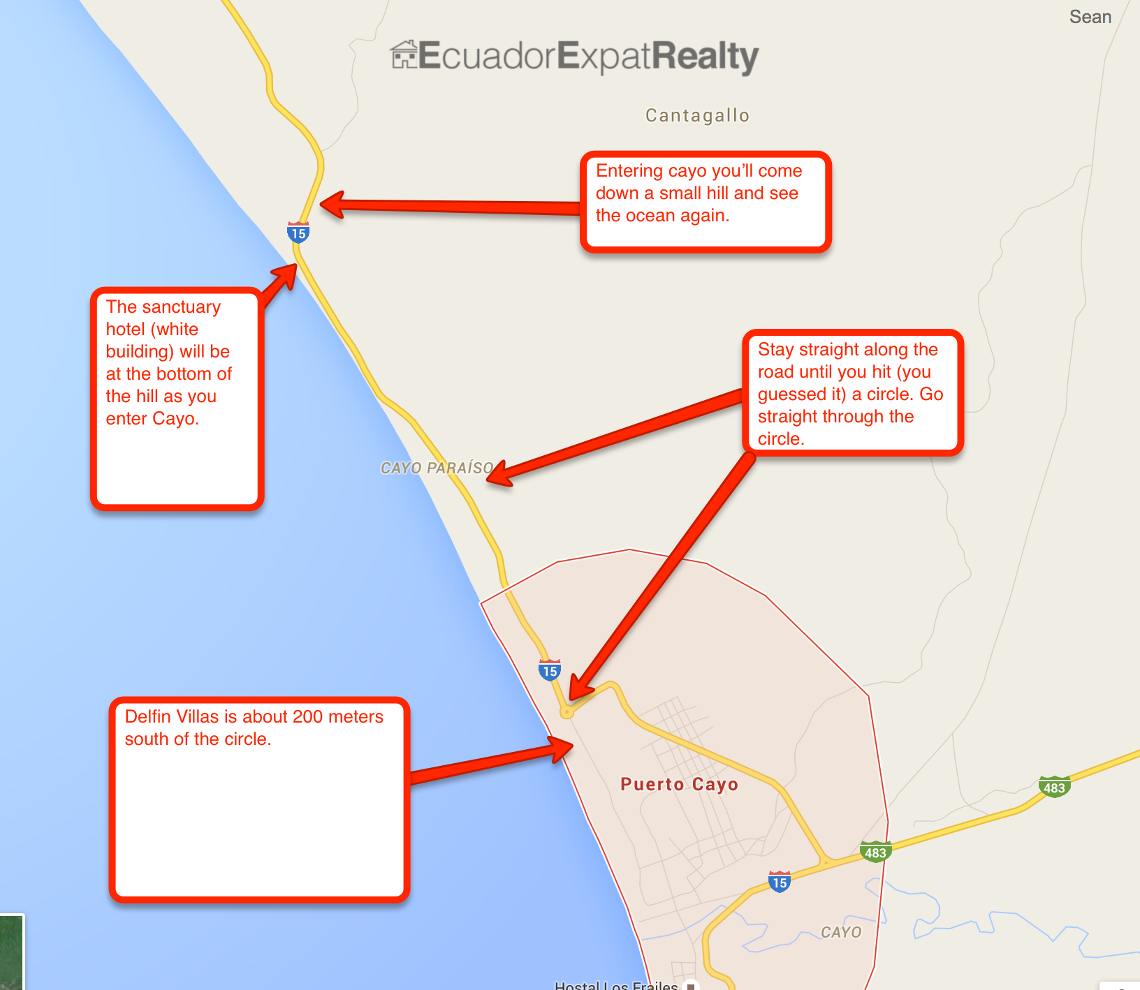
1) Once you pass Mirador, just keep on the road, it’ll have a couple curves and eventually you come around a curve that will open up to ocean going down a hill. As you head down to meet the ocean you’ll see the beachfront hotel “The Sanctuary” (White Building). Next door is “Alebrije” (Restaurant). You have entered into the beginning of Puerto Cayo.
2) Stay along the road all the way until finally arriving at the last circle in the route, which you can go straight through. (Clarification: Don’t drive physically straight through the circle, that will end poorly. “Straight through” in this context is to say, take the exit of the circle directly opposite where you are entering to it. : )
3) Delfin Villas is about 200 meters south of the circle.
This article was originally posted on www.ecuadorexpatrealty.com. All copyright and trademark protections apply.
0 Comments
Leave A Comment